Baramahal

From: British Library
This article has been extracted from THE IMPERIAL GAZETTEER OF INDIA , 1908. OXFORD, AT THE CLARENDON PRESS. |
Note: National, provincial and district boundaries have changed considerably since 1908. Typically, old states, ‘divisions’ and districts have been broken into smaller units, and many tahsils upgraded to districts. Some units have since been renamed. Therefore, this article is being posted mainly for its historical value.
Baramahal
A name loosely applied in English histories to the north-eastern corner of Salem District, Madras, but no longer in use. The exact boundaries of the tract have been the subject of some discussion. It apparently included the taluks of Tiruppattur, Krishna- giri, Dharmapuri, and Uttangarai in Salem, and the Kangundi zaminddri in North Arcot. Though usually called Baramahal, the name is explained as meaning ' twelve palaces ' (mahal), and tradition says that it was derived from the fact that twelve hills within it were fortified by local chieftains ; but of the various lists of these twelve forts no two agree. The first separate ruler of the tract is supposed to have been Jagadeva Raya, father-in-law of one of the fallen kings of Vijaya- nagar, to whom it was granted by the king as a reward for his heroic defence of the fort of Penukonda against a Musalman force. Later, Jagadeva's family fell upon evil days, and the Baramahal passed into the possession of Haidar All of Mysore, whose son ceded it to the British at the partition treaty of 1792. The name soon afterwards dropped out of use.
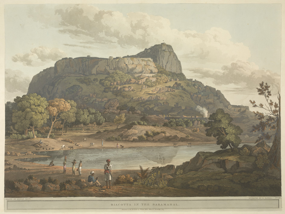
Henry Salt's 'Twenty Four Views in St. Helena, the Cape, India, Ceylon, the Red Sea, Abyssinia and Egypt'
This aquatint was taken from plate 12 of Henry Salt's 'Twenty Four Views in St. Helena, the Cape, India, Ceylon, the Red Sea, Abyssinia and Egypt'. Salt visited Rayakottai in Tamil Nadu on his way to the Cauvery Falls. Viscount Valentia George Annesley wrote of its importance as a point of communication between Mysore and the Carnatic: "[Governor General] Lord Cornwallis ... had the fortifications strengthened. At present they consist of the hill, whose top is only approachable by a narrow flight of steps, and a fort at the bottom where are very comfortable houses for the officers. The scenery is wild and abrupt, consisting of rocky hills, with woods and jungle between ... the climate is so moderate, that every kind of fruit and vegetable may be reared in a degree of perfection that is unknown on the sultry plains around Madras."
Viscount Annesley’s description
Viscount Valentia George Annesley [2nd Earl of Mountnorris FRS (4 December 1770 – 23 July 1844)] wrote of its [Rayakottai’s] importance as a point of communication between Mysore and the Carnatic: "[Governor General] Lord Cornwallis ... had the fortifications strengthened. At present they consist of the hill, whose top is only approachable by a narrow flight of steps, and a fort at the bottom where are very comfortable houses for the officers. The scenery is wild and abrupt, consisting of rocky hills, with woods and jungle between ... the climate is so moderate, that every kind of fruit and vegetable may be reared in a degree of perfection that is unknown on the sultry plains around Madras." (From The British Library