Assam- Mizoram border dispute
This is a collection of articles archived for the excellence of their content. |
The background
History and position as in 2021 July
Pinaki Chakraborty, July 14, 2021: The Times of India

From: Pinaki Chakraborty, July 14, 2021: The Times of India

From: Pinaki Chakraborty, July 14, 2021: The Times of India

From: Pinaki Chakraborty, July 14, 2021: The Times of India
Grenades were lobbed at road construction workers in Cachar district, Assam, near the Mizoram border on July 10. This has put the spotlight back on the long-standing inter-state boundary issue in the Northeast, particularly between Assam and the other states in the region. Assam shares its border with six other states.
Long-standing dispute
This isn't a one-off incident. It is a dispute that has gone on for over 100 years now. At the heart of the issue is the 164.6-km border that separates Assam and Mizoram. Three districts of Assam — Cachar, Hailakandi and Karimganj — share a border with Kolasib, Mamit and Aizawl districts in Mizoram.
The Northeastern Areas (Reorganisation) Act, 1971, led to three new states being carved out of Assam in the region, namely Manipur, Meghalaya and Tripura. Along with these, the Union Territories of Mizoram and Arunachal Pradesh were created. A British era hangover As with most border problems among states in the Northeast, this too is a British legacy. Till 1830, Cachar was an independent kingdom. When its king was killed leaving no heirs, the British moved in and annexed the kingdom in 1832. (This was under a policy known as a doctrine of lapse, under which the East India Company, and later the British Raj, annexed any kingdom where the ruler died without a direct successor.)
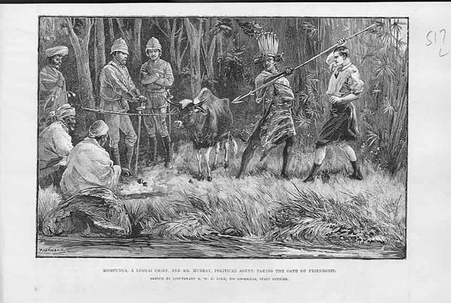
The British plan was to start tea plantations at the foothills of the Lushai (or Mizo) hills. The local tribals, i.e. the Mizos, were not happy with that and as a result would raid British territory regularly.
Troubled by the constant raids, the British introduced the Inner Line Regulation (ILR) in 1875 in a bid to separate “their” territory of Assam from the hilly, tribal regions. The Mizos welcomed this, as they felt that their land would not be encroached upon any more.
However, in 1933, the British created a more formal border between Cachar and the Mizo hills, a process in which the Mizos were not involved. The Mizos agitated against this new boundary, and wanted the 1875 ILR to be enforced.
Post-independence challenges
In 1950, Assam became a state of India. At the time, Assam included what is today Nagaland, Arunachal Pradesh, Meghalaya, and Mizoram. As each of these areas became states independent of Assam, there have been border disputes between them and Assam.
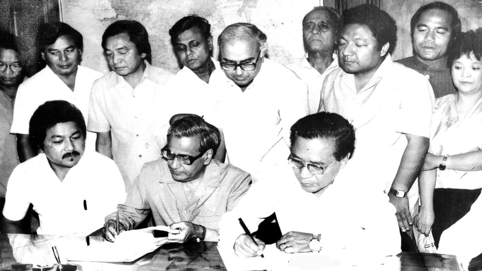
Mizoram was made a state in 1987 following the Mizo peace accord signed between the Mizos and the Union government. While the basis for the state was the 1933 agreement, the Mizos insist that the earlier 1835 ILR border is what they accept. There have been constant clashes along the border.
Assam and Mizoram have signed an agreement under which status quo is to be maintained in no-man’s land, or the border areas. That, however, hasn’t brought an end to the disputes.
In 2020, the Centre had to step in to resolve an impasse after border clashes led to an unofficial road blockade of Mizoram’s lifeline, National Highway 306. A land-locked state, Mizoram depends on this road for supplies from the rest of the country.
Why have the clashes not stopped?
The border here is an imaginary line that changes with rivers, hills, valleys and forests. Both sides have a different perception of where the line lies. Over the years, what started off as a geographic problem has now also become an ethnic issue.
Many of the residents on the Assam side of the border are Bengalis, mainly Muslims, whom Mizos view with suspicion alleging that they are undocumented migrants and would land up illegally in their state.
In some of the northeastern states, the rate of growth of the Muslim population has been much faster than the Hindu population. But in most cases, that can be attributed to a low-base effect.
Many of the residents in the Assam side of the border are Bengalis, mainly Muslims, whom Mizos view with suspicion alleging that they are undocumented migrants and would land up illegally in their state.
In states like Mizoram, the population of Muslims grew by a whopping 122.54 per cent between 1991-2001 according to the Census. But in terms of absolute number, there were 10,099 Muslims during the period when census operation was carried out in the state in 2001. They are just 1.3% of the total population of the state.
Talks remain inconclusive The border dispute dialogue between Assam and Mizoram remained inconclusive when they met last on July 9 with Aizawl seeking more time for further consultations on Assam's proposal to maintain status quo along the border and withdrawal of security forces from the disputed areas.