Flora: Pakistan
This is a collection of articles archived for the excellence of their content. Readers will be able to edit existing articles and post new articles directly |
Contents |
Chilghoza Trees
Sulaiman Range
Counting on chilghoza trees
By Rina Saeed Khan
The world’s largest pure stands of chilghoza, the Asian variety of pine nut, are found in the forests up in the Sulaiman Mountains, near Zhob. The Sulaiman Range is an extension of the Hindu Kush mountains into Balochistan. The steep mountainous terrain, with hot and dry summers and cold winters provides unique ecosystems and is home to endangered animals like markhor and the black bear
The drive through the rugged Sulaiman Range from Dera Ismail Khan to Zhob is spectacular. Most of the bridges are not yet complete, but the road is in good shape and one can commute to Zhob in less than four hours.
On the way, one comes across hundreds of Kuchis (Afghan nomads) who seasonally migrate to Pakistan for the winter months. Dressed in traditional black, embroidered robes, accessorised with silver jewellery, they camp in tents open to the winds near the water streams that crisscross the road. They come every year with their livestock and also allegedly deal in lucrative arms trading along the way! They are mostly well dressed and look well fed.
The world’s largest pure stands of chilghoza, the Asian variety of pine nut, are found in the forests up in the Sulaiman Mountains, near Zhob. The Sulaiman Range is an extension of the Hindu Kush mountains into Balochistan. The steep mountainous terrain, with hot and dry summers and cold winters provides unique ecosystems and is home to endangered animals like markhor and the black bear.
These forests are very important for the economy because chilghoza nuts can fetch a good price in the market. The growing demand for chilghoza nuts in international markets of Dubai, Muscat, Jeddah, London and even Israel makes this commodity a very important source of earning foreign exchange.
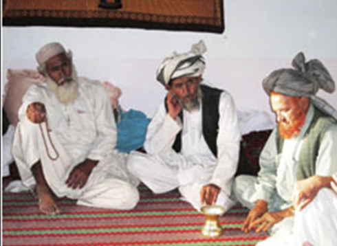
“We pay up to Rs24,000 per 40 kilograms of chilghoza nuts,” explained Haji Qasim Khan, a merchant from Dera Ismail Khan. “The big market is in Lahore. We send 80 per cent of the chilghoza nuts to Lahore, where many are peeled and then exported abroad. The chilgozha nuts found here in the Sulaiman Range are amongst the best in the world.”
Haji Qasim Khan is in Zhob at the invitation of Worldwide Fund for Nature-Pakistan (WWF), the international conservation NGO which has an office in Zhob town. WWF-Pakistan is hoping to cut down the role of the middlemen who make huge profits by buying chilghoza from the local people and then selling them to the big merchants. The NGO would like the merchants to buy directly from the local communities, so that the latter can benefit directly from the sales.
“We have asked the local villagers not to cut the chilghoza trees to sell their wood. They only get Rs2,000 per tree for the timber. But if they harvest the chilghoza nuts from the trees, they will get more than Rs10,000 per tree every year. The communities are starting to listen now.
“In fact, we have constituted a community based Chilghoza Forest Conservation Committee and they are enforcing a fine of Rs10,000 on any villager cutting a green chilghoza tree in their area. People realise now that these trees are precious. We want them to get the proper price for the chilghoza nuts,” explains Bazmir Khan, who works for WWF-Pakistan.
This project, which is funded by the European Union through the UNDP’s small grants programme to promote tropical forests, is currently working in targeted villages of the Pakhtoon Sherani tribe in the Sulaiman Range, who own almost 1200 square kilometres of pure chilghoza forest.
The chilghoza forests have come under threat recently from the over-collection of timber for sale and for fuelwood. Villagers take loans from the contractors, who later cut the trees to get their money back. With the funding from the European Union, WWF-Pakistan is helping to improve the management of these forests in this remote and poverty stricken region. They have highlighted the importance of chilghoza forests in 18 villages, hence covering over one-third of these forests and a population of 5,500 people.
The local communities are becoming aware of the fact that in a good year, the value of nuts produced by a single chilghoza tree is higher than the timber value of an entire tree. “Previously, the villagers would take out chilghoza pines too early and damage the trees. Now we have taught them the best time for extraction, which is early September, and have given them special equipment to cut the cones,” explains Khan.
At lower elevations, the chilghoza forests give way to olive and mixed scrub forests (including pistachio and acacia). This area is rich in wild fruit, nuts, medicinal plants and mushrooms. At lower levels, there are flat valleys with good grazing and agricultural land.
The project is also helping to reduce the villagers’ dependence on the forest by improving agricultural productivity. The water channels had almost stopped functioning because of all the tribal feuds that are common in this region. The NGO has acted as an intermediary to settle disputes and has helped in irrigating more than 18 acres of land. Now the villagers can grow onions and other vegetables which fetch good prices in the markets. The local people are also growing apples, grapes and pomegranates.
According to Ashiq Ahmad of WWF-Pakistan, who oversees the project from Peshawar, “We are trying to help reduce the people’s subsistence on the forests. We held a workshop in the area in February last year where we invited the local villagers and government officials. By highlighting the importance of the chilghoza forests, we are spreading awareness in the area.”
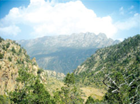
WWF-Pakistan’s project field office is located around an hours’ drive from Zhob town, deep in the Sulaiman Range. We spent the night at the office, which is merely a cluster of mud and thatched rooms with a protective stone wall and is perched on top of a ridge. Below us were the agricultural fields owned by the local villagers. Nearby was a stream which provides fresh water flowing down the mountains that encircle the valley. These are arid, stone mountains, almost blue grey in colour that looms up in the distance –– forbidding and austere. They are also very difficult to climb, as we discovered the next day!
We wanted to see the chilghoza forests, and in order to do that we had no choice but to climb the mountains. The chilghoza trees are only found at higher elevations. Accompanying us was a local tribesman, Yar Mohammad, a member of both the Shirani tribe and the Chilghoza Committee, who looked striking in his grey turban, with a kalashnikov slung across his shoulder. Yar Mohammad lives in the nearby village of Ahmadi Daragh. He was our guide and saviour on our way up when the terrain became extremely hostile!
We set off at 5am, with donkeys laden with food and knapsacks leading the way. After what seemed like hours trekking through a stony river bed (dangerous during rainy season when hill torrents can come cascading down the mountain, sweeping away rocks and anything else along with the sheer force of the water), we finally started climbing. The higher we climbed, the cooler it became. We had plenty of water in our canisters, filled at a fresh water spring on our way up. There is no water at the top of the mountain, so it is important to carry it with you.
The team was surprised when we had to stand aside to give way to camels going down the narrow mountain track, almost half way up. “The camels go all the way up –– they are less in number now. Previously the local people would use them extensively to bring down timber from the mountains,” explained Bazmir Khan, who was also accompanying us. “The local people have started cutting fewer trees now –– they respect the ban that is in place. They only bring down the older trees which have dried up to either sell or use for fuelwood.”
Although this area is a part of Balochistan, there is no Sui gas in Zhob district. The people are very peaceful, though, and not actively involved in the provincial politics since they are all Pakhtoon and mostly members of the same tribe, the Sherani (which stretches into the NWFP side as well). There is little crime in this tribal area and the people are very hospitable. However, Yar Mohammad’s kalashnikov was a reminder that there are plenty of local feuds going around in this remote corner of Pakistan.
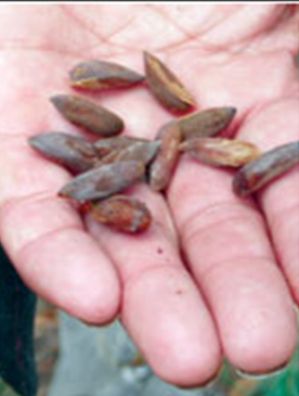
As the track started getting narrower and steeper, we came across our first chilghoza trees, which looked delicate and spindly like mini-pine trees, but these were young trees and we had yet to reach the dense forests above. We took a break for tea by climbing up to a summer camp. Near the camp, hundreds of pine cones were littered by the makeshift shelter. We had just missed the harvesting, it seemed, for the local villagers had already extracted all the chilghoza nuts and then buried them in safe hiding places.
“They will come for them in a week or so –– they are letting them dry out a little”, explained Yar Mohammed. He discovered one or two hiding places as well and showed us how the nuts are taken out of the cones. It seemed like a backbreaking job.
Our final hike to the top of the mountain, called Pazi, was hampered by a landslide which had swept away the track. After around half an hour of climbing, we finally reached the top. There was plenty of new growth of chilghoza trees which was an encouraging sight. “In another 20 years, this will be a thick forest,” explained Bazmir. “The average chilghoza tree lives up to around 100 years and gives fruit every year.”
Just across us on the other side of the valley was the famous Takht-e-Sulaiman (probably around 1,000 feet higher). There is a shrine at the top which is said to be the tomb of the founder of the Pakhtoon race!
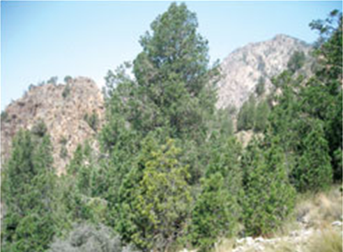
The sight of the dense chilghoza forests on one side of the mountain top –– which was shaped almost like a plateau rather than a pointy top, made one forget the arduous trek up the mountain. To the right was a splendid spectacle –– a forest so thick that one could not even see the mountain slopes. In between were the blue pine trees. The blue pine is a beautiful tree, almost like a Christmas tree, but even prettier with its blue-green colouring and dense pine needles.
There are no villages or settlements on the mountain –– when the sun sets, it gets very cold and there is no water at this height. The local villagers, who are tough mountain people, can easily trek up and down in a few hours. If need be, they spend a few nights during harvesting season, lighting a huge fire to keep warm at night.
We had the option of spending the night at the camping place, but by now the mountain was turning inhospitable and severe. It was very painful coming down in joggers (one needs proper hiking boots for this kind of trekking) and the stones were causing one to stumble along. By the time we reached the riverbed, it was dark already but luckily we had torches to light our way. From a distance we spotted the jeep that was waiting for us and by 8pm we had finally made it back. “This is a hard mountain” Yar Mohammed told us. “Not many visitors can go up and down in one day!”
Yet for the local people this is an everyday reality. They go up and down these mountains at least once a week to get fuelwood and timber. During the harvesting season in early September, they go up almost every day. One comes away from the mountain with renewed respect for these tough, dignified tribesmen. With the right guidance and encouragement, they have a bright future ahead of them.
The market for chilghoza pines is only going to get bigger and as the demand grows, so will the prices. Already, each family in the area makes around Rs50,000 per year from selling the chilghoza nuts grown in these community owned forests.
By organising the villagers and teaching them how to manage their precious forests and market their produce, the project has not only helped save the forests but also brought the people closer together to live in peace and harmony. The remaining chilghoza forests in Balochistan can now be saved in the same manner.
Steep terrain
The Sulaiman Range is located inside Pakistan and sprawls over three provinces: the North West Frontier Province, Punjab and Balochistan. The mountains vary from 500 to 3,350 metres in altitude. The highly steep mountainous terrain and the harsh climate (hot and dry summers and the cold winters) is host to the largest pure chilghoza forest on earth.
The mean maximum day temperatures range from about 37°c in June to about 13°c in January, and rainfall averages 320mm per year, but varies significantly with altitude. The chilghoza forest ecosystem is a combination of habitats stretching along an altitudinal gradient which, in turn, support a variety of species of plants and animals. Many species are endangered nationally, regionally and globally. Many other species are economically important, and there are several wild relatives of cultivated plants.
At the higher altitudes, chilghoza (pinus gerardiana) grows on steep terrain and high plateaus, and forms the upper watersheds of the Sulaiman Mountain Range. The chilghoza forests of the Sulaiman Range are unique ecologically and have a tremendous socio-economic importance for the local communities. The pure chilghoza stands lie between 2,133m and 3,353m. In total, approximately 26,000 hectares remain.
Wild olive forests and mixed scrub forest (notably acacia and pistachio) lie in the zone between 1750m and 2,400m. All the chilghoza forests in Zhob district lie in the Sherani tehsil (sub-district). — WWF-Pakistan
Falsa
Purple magic
By Zarina Patel
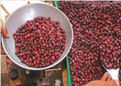
Falsa is often mistaken for North American blueberry, but it is a fruit that is as Asian as it gets.
Falsa or grewia asiatica originated from South India, but is now an extremely popular summer fruit in the subcontinent and is widely grown in Pakistan, India, Bangladesh, Sri Lanka, Nepal and even the Philippines. Falsa is an extremely sought-after summer relish and ranks third on the list of most popular summer fruits after mangoes and peaches.
It is an exotic bush plant and the sweet and sour ripe falsa fruits are consumed fresh, in desserts, or processed into refreshing fruit juices and soft drinks enjoyed during hot summer months. However, the falsa fruit has a short shelf-life and is considered suitable only for local marketing and day-to-day consumption.
The young plant starts fruiting after three years of cultivation. The fruit grows rapidly for the duration of summer from bunches of yellow-orange flowers. It attains maturity within 40 to 45 days. The size of the individual fruit is about 1.0 to 1.9 in diameter. The falsa tree flourishes under strong sunlight and hot temperatures and yields high-quality fruit.
It is highly eulogised for its unique blend of tangy-sweet flavour and medicinal values.
A ripe falsa is soft and succulent. The malleable skin surrounds the fibrous purplish-maroon flesh and a hard tiny seed.
Because the fruit starts to deteriorate soon after it ripens, people like to chomp it fresh with a sprinkle of salt and black pepper, and sometimes sugar to enhance the taste.
A glass of falsa juice with pulp is loaded with magnesium, potassium, calcium, carbohydrates, vitamin A and C, iron and sodium. Cool, refreshing and digestible properties of the juice give it the status of an ideal summer tonic. It heals irritation, swelling and redness which appear due to too much sunlight exposure and excessive heat. Its revitalising effect also puts a stop to the damaging effects of sunstroke. Surprisingly, the sweet and sour juice also provides protection against cough and sour throat.
Both unripe and ripe forms of the fruit are used for the treatment of bodily disorders and diseases since time immemorial. Young falsa fruits are sharp-tasting and are useful for the treatment of liver and gall bladder disorders (biliousness). It is also reputed for its healing power in people with blood and urinary tract disorders. The presence of potassium in the fruit keeps blood pressure on track. It provides comfort from acidity. One of its components, anthocyanin, prevents heart trouble and restrains cholesterol formation.
Recently, scientists have discovered the radioactive potential of the plant. Moreover, the presence of anthocyanin flavonoids and vitamins make falsa a valuable source against the threat of cancer.
Its leaves, bark, stem and root barks have been used in folk medicine for centuries. For example, the solid covering of the woody stem is soaked overnight in water and used to treat skin injuries and to alleviate fever. The leaves of the falsa plant have antibiotic effects and its root bark is found useful for the treatment of rheumatism. The leaves, pruned stem and bark of the plant are used by natives of the rural areas for many purposes such as making ropes, baskets, sticks, and coarse food for cattle and horses. The stem bark of the falsa plant is also used for cleaning sugarcane juice during the processes of making brown sugar. To sum it all up, falsa is among the many wonderful gifts that nature brings us every summer.
Jhika Gali and Bhurban
Progressing backwards
By Zahrah Nasir
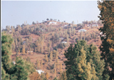
The sound of blasting reverberates through what remains of a once dense forest on a dangerously steep slope below the Garial Ridge, mid-way between Jhika Gali and Bhurban; yet another new road is under construction. The roar of heavy machinery, the echoing shouts of boisterous labourers, a shrill warning whistle as yet another charge is primed to explode, all combine to shatter the previously natural peace as more trees bite the dust in the supposed name of progress.
This particular operation is intended to provide a ‘short cut’ from just outside Kashmiri Bazaar on the ‘known’ side of the mountain, to the lesser known village of Aliot lying on the main Kashmir Highway on the opposite side of the mountain. The new route will cut at least thirty minutes, if not more, off the travelling time from Jhika Gali to Khohala, the main entrance point to Azad Kashmir from Rawalpindi…or so it is locally claimed although the new Governor’s House at the Kashmiri Bazaar end of the road just may have something to do with it
This particular apology for a road, there is even a ludicrous roundabout on top of the ridge, is supposed to eventually connect with yet another partially constructed road which begins near the laughable, if it wasn’t so ultra-expensive, under construction Bhurban Cricket Stadium, then snakes around the previously pristine mountainside to, eventually, connect with the one on the Garial Ridge.
Neither road is, in reality, more than single track, poorly surfaced, where it is surfaced at all and has, despite an almost non-existent winter, deteriorated badly since being opened to traffic less than one year ago. The roads will be blocked if it snows and both, the one on Garial Ridge in particular, are extremely prone to landslides where the mountainsides have been completely destabilised by road construction and the associated, totally unprofessional, blasting.
Local residents celebrated the life changing arrival of road access, land prices shot up overnight along with illegally constructed houses, many of them ‘holiday homes’ and an entire way of life entered the pages of history.
Living, as we do, on the new link road from Bhurban, we are helpless witnesses to the changes around us. The ever increasing environmental degradation is rapidly destroying this mountainside, along with every other mountainside in the vicinity which has now been provided with some form of road access.
Amongst the very first vehicles to drive past our home was a pair of four wheel drive jeeps, hired from a village up on the main road, bursting at the seams with gleeful men. Nothing unusual about this except that they drove down at 2am and back up as the first pink rays of dawn pierced the sky above the Pir Panjal range of mountains across the Jhelum Valley over in Azad Kashmir. The intrusive revving of engines as the jeeps tried to get back up the very steep slope before our home woke us up and set our dogs barking madly. The timber mafia in action!
These new roads, intended to improve the standard of living for indigenous people, have allowed vehicular access to areas of forests which are now increasingly under threat. Not that these areas were totally ‘unthreatened’ before; local people have always stolen trees for fuel cooking and heating fires, for use in construction and to sell for a cash income whenever they get the chance.
Before the advent of the road, stolen timber was either manually carried out or hauled by mules and donkeys. The process now being so much easier, the volume of theft has increased accordingly with the locals, and government employed forest guards who are not themselves actively involved, happily accept a cash bribe to turn the other cheek.
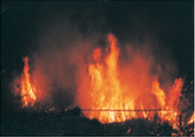
After the deed come forest fires intended to destroy the evidence and, even at this ‘green’ time of year, forest fires are a daily occurrence which speaks volumes about how much timber is being stolen. Tree cover is becoming thinner and thinner, landslides more common, flora and fauna alarmingly endangered, even bird species have decreased over the last ten years, facts which we can personally testify to.
In this mountainous region it has always seemed that every other person is a property dealer and never more so than now. With land prices ranging from 800,000 to 1400,000 per kanal in this particular area now that road access is a reality, local people are either selling up and moving on to new pastures where their ‘loot’ doesn’t last long at all or selling off yet another parcel of land each time their existing money runs out.
Illegal constructions are coming up at a runaway pace with, naturally, even more trees being felled in the process. The pressure on extremely limited water resources obviously increases with every per head addition to the population, be it seasonal or otherwise. Tube wells are suddenly in vogue, aggravating an already acute problem by further lowering the water table, the lack of snow last winter has already resulted in numerous springs running dry, all this on top of the catastrophic earthquake last year which changed some underground water courses entirely.
New residents also expect to be able to sit around log fires in the evening, seeing this luxury as part and parcel of their mountain experience. No one seems to realise that the forests, indeed each and every single tree in the area, will cease to exist unless drastic action is taken.
The government instigated programme of providing piped gas to Murree and the surrounding villages will not, despite claims to the contrary, have much impact on the number of trees cut for fuel each year as, other than large hotels which mainly use bottled gas not firewood at the moment; local people will not pay the price for a gas connection let alone its monthly consumption.
Tree planting campaigns are launched from time to time but few people are concerned enough to get involved. A large landowner in the Bhurban locality did, surprisingly enough, accept a grant to plant hundreds of horse chestnut trees a few years ago. The tiny trees, planted far too close, left unweeded and un-watered, were mostly consumed by goats and those that managed to survive were bulldozed into obscurity when the same landowner decided that profit preceded environmental concerns, constructing a number of high-rise apartment blocks on his land instead.
Mangrove forests in Sindh facing degeneration
By Nasir Ali Panhwar
THE 2004 tsunami made it amply clear that healthy mangroves serve as a natural barrier against natural or man-made disasters – protecting infrastructure and saving lives. Coastal communities depend heavily on mangrove ecosystem for their daily life; they provide a range of functions and benefits to them. The loss and degradation of these ecosystems impact heavily on these communities in economic and social terms. In the aftermath of the tsunami, these impacts were exacerbated.
Former US president Bill Clinton, who is the UN Secretary-General’s special envoy for tsunami recovery, launched the “Mangroves for the Future” Initiative in Phuket, Thailand, in December to mark the second anniversary of the tsunami in which 230,000 people lost their lives, mostly in Indonesia. He visited the region to review progress on home construction and livelihoods. He visited Hin Look Dieu, a small Moken (sea gypsy) community that experienced substantial destruction in the tsunami. The government and the community are collaborating to restore the deteriorated mangrove forest in the area.
According to an estimate, over 600,000 hectares of Pakistan’s coastline is under mangrove forestation. The coastal communities as well as the fisheries of the coast are dependent on this ecosystem, their very existence entwined with its well being. However, despite being one of the most extensive mangrove forests in the world and having considerable importance for the national economy due to their role in fisheries, their significance in terms of ecological and economic value have remained undocumented and poorly understood.
Historically, mangroves have been considered as wastelands. The alarming reduction of vital flow of the Indus River into the Indus Delta, which constitutes one of the most extensive mangrove areas along the Pakistani coast, is one of the major factors contributing to mangroves degradation. Besides, pollution caused by a variety of industrial effluents, sewage, solid waste is also detrimental for the mangroves. The area is also affected by increased salinity due to upstream irrigation. The mounting pressure of the rapidly increasing population has led to the clearing of mangrove areas for industrial and agricultural purposes as well as for urban expansion, undermining the livelihoods of the coastal communities and thereby exacerbating their poverty.
The most severe environmental stress, which the mangroves face, is the reduction of freshwater flow down the Indus. While mangroves, especially Avicennia marina, are able to survive in sea water without regular fresh water input, it is unlikely that they can thrive indefinitely. The Indus Delta was formed from the fresh water flow into the sea carrying 400 million tones of silt. Over the years the flow recharging the delta has reduced drastically. The reduced flow in Indus means that the already high salinities in the creeks and soil will become higher.
This tends to have a stunting effect on the growth of trees. There is significant impact on the mangroves forests, and there are signs of stress already in an ageing population of trees, with lack of seedling requirement in some areas. The reduction in the flow takes on an even greater significance when possible sea level rise as a result of global warming is considered.
It has been estimated that mangroves, if there is significant sedimentation, can maintain themselves by accumulating deposited salt when the sea level is rising at the rate as high as 2.5 mm per year. Without significant sedimentation, the mangroves will have difficulty in maintaining themselves against sea level rises of 1.2 mm per year. It is probable that the Indus Delta may be moving from former position to the latter. Over the last hundred years the sea level near Karachi has been rising at a rate of 1.0 mm per year and this may increase with global warming.
Management through sustainable use of mangrove resources, their protection and conservation should be a key priority for the country. Understanding the mangrove ecosystems is imperative to improved management in order to derive optimum economic and environmental benefits without destroying this valuable ecosystem. There is a need for the creation of awareness and education among planners and coastal communities regarding the sustainable management of mangrove forests. In this context, it is necessary to understand the dynamics of the mangroves through interdisciplinary studies.
Originally launched in September 2005, “Mangroves for the Future” initiative is a multi-agency, multi-country initiative for the long-term conservation and sustainable management of coastal ecosystems such as mangroves, coral reefs, wetlands, forests, lagoons, estuaries, beaches and sandy shores. It targets countries that are recovering from the Indian Ocean tsunami. Its “focal countries” are some of the worst-affected nations: India, Indonesia, Maldives, Seychelles, Sri Lanka, and Thailand
The initiative will also encourage a dialogue and sharing of information and experiences with other tsunami-affected countries in the region that face critical ecosystems and livelihood issues. These include Bangladesh, Kenya, Malaysia, and Tanzania. More countries within the broader region will also be brought into these dialogues, such as Cambodia, China, Pakistan, the Philippines and Vietnam.
The project involves collaboration between multiple partners, including government agencies, NGOs, research institutes and universities, the World Conservation Union (IUCN), UN agencies and other multilateral bodies. It provides a platform, which brings together the efforts of different countries, sectors and agencies under a common goal to conserve and restore ecosystems to sustain human livelihoods, increase resilience and reduce vulnerability among coastal communities in the Indian Ocean Region.
Mangroves for the Future is one of the first initiatives dealing with coastal areas of Indian Ocean countries to build and formalise such a wide-reaching collaborative platform, which brings together governments, international agencies, non-government and community-based organisations, the private sector and local communities to work towards a common goal, investing in protecting coastal ecosystems. At the regional level, implementation of the initiative will be supported and guided by a regional steering committee co-chaired by the World Conservation Union (IUCN) and the United Nations Development Programme (UNDP), UN agencies and NGOs. Programmes of work will be implemented through a series of individual actions that are linked by a common goal and strategy, but are spread out geographically, temporally, and in terms of management and implementation responsibility.
Reducing poverty and strengthening livelihoods are its core goals in line with the aims of national Poverty Reduction Strategy Papers (PRSPs) of participating countries as well as with the broader framework of the Millennium Development Goals (MDGs). These needs are incorporated into the project’s vision which lays focus on a more healthy, prosperous and secure future for all sections of coastal populations in Indian Ocean countries, and restoration of coastal ecosystems there.
Besides, strengthening the integration and enforcement of environmental and social safeguards in coastal land use planning is one of the core objectives of the initiative. Land use planning involves identifying the most suitable use of the coastal zone in relation to its physical and ecological characteristics and resources, and human needs. It is essential to integrated coastal management. Spatial planning is particularly important on the coast because of its vulnerability to disasters.
Most of the countries participating in the initiative have a voluminous, and often comprehensive, body of laws and regulations governing land use in the coastal zone. However in many cases regulations are weakly enforced, if at all, meaning that illegal land and resource use takes place, often in an environmentally unsustainable manner. Not all countries contain an integrated land use policy or strategy for coastal areas, and where they exist these policies and strategies are not always implemented.
